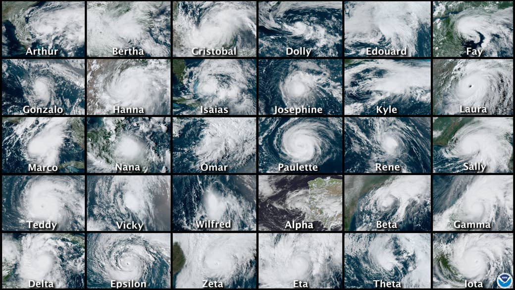
The busiest hurricane season on record in the Atlantic Ocean is now over — maybe, hopefully, fingers crossed — after producing a whopping 30 named storms.
“It’s really unbelievable how busy it has been,” Suzana Camargo, a hurricane researcher at Columbia University, told BuzzFeed News.
This hurricane season blew through predictions from federal scientists, who were expecting a busy year for storms, setting a string of new records along the way. It was the Atlantic’s most active hurricane season in the satellite era, producing 30 named storms and 13 hurricanes. An average season has 12 named storms and 6 hurricanes.
There were so many storms that, for only the second time ever, meteorologists used up the original list of 21 names and then had to name subsequent storms using letters of the Greek alphabet.
This was also the first year that 12 named storms made landfall in the US. And it was an especially bad year for Louisiana, which was hit by a record five storms that killed dozens and left thousands homeless during a deadly pandemic.
The mayhem kicked off early, with two storms forming before the season’s official June 1 start date, and continued in high gear until almost the end of November, when the season officially ended. In mid-September, five tropical cyclones were active in the Atlantic Basin simultaneously.
As storms continued to develop through November, the National Hurricane Center’s main Twitter account summed it up best: “Ugh.”
Fueling this exceptional season was a mix of factors, including warmer sea surface temperatures, driven in part by a natural decadeslong warming trend in the Atlantic, an active African monsoon season, and a move late in the season into a La Niña phase in the Pacific Ocean — which allows more and stronger Atlantic storms to form.
There’s also human-made climate change. But that’s where things get a little dicey. According to Michael Wehner, a senior staff scientist at Lawrence Berkeley National Laboratory, “the great unknown question” is how climate change impacts the total number of hurricanes. He pointed out that our data on past hurricanes is limited — there are likely storms that lived and died out in the middle of the ocean missing from the pre-satellite record.

However, hurricane experts can say global warming is fueling something else: Storms, in the Atlantic and elsewhere, are likely getting more intense than they would without climate change. Specifically, warming is expected to make the most intense storms even stronger, and a review of tropical cyclone activity over the past four decades suggests this is already happening.
With warmer water and air temperatures, there’s more energy to power any given storm. “If the conditions are perfect for a hurricane, all else equal except more energy is available, they are going to be more intense,” said Wehner.
The warmer air holds more moisture too, meaning that storms are producing heavier rains and triggering more inland flooding.
The total energy of this year’s Atlantic storms, while well above average, didn’t make the top 10 years in the historical record. But some scientists propose global warming could also fuel more rapid intensification of storms. That’s a dangerous trend because it’s hard to forecast and prepare people to evacuate when storms strengthen so quickly. And in 2020, 10 of the storms rapidly intensified, meaning they strengthened by 30 knots (roughly 35 miles per hour) in 24 hours.
“I keep hoping these busy Atlantic seasons will be a wake-up call for people who are making and keeping policy in the US that is murderous for people,” said Kerry Emanuel, a hurricane expert at MIT. “We keep moving to the coast and building there, so we are putting more stuff in harm’s way and it’s a terrible problem.”
Here’s a list of all the 2020 tropical cyclones in the Atlantic. The storms are ordered based on when the National Hurricane Center started issuing advisories, which may differ from the order in which they reached tropical storm strength and were officially named:
1. Tropical Storm Arthur (May 16–19):
Arthur, the first named storm of the season, was a relatively weak storm that produced minor flooding in Cuba, Florida, and North Carolina.
2. Tropical Storm Bertha (May 27–28):
Bertha was a brief storm that made landfall in South Carolina and caused minor flooding along the coast.
3. Tropical Storm Cristobal (June 1–9):
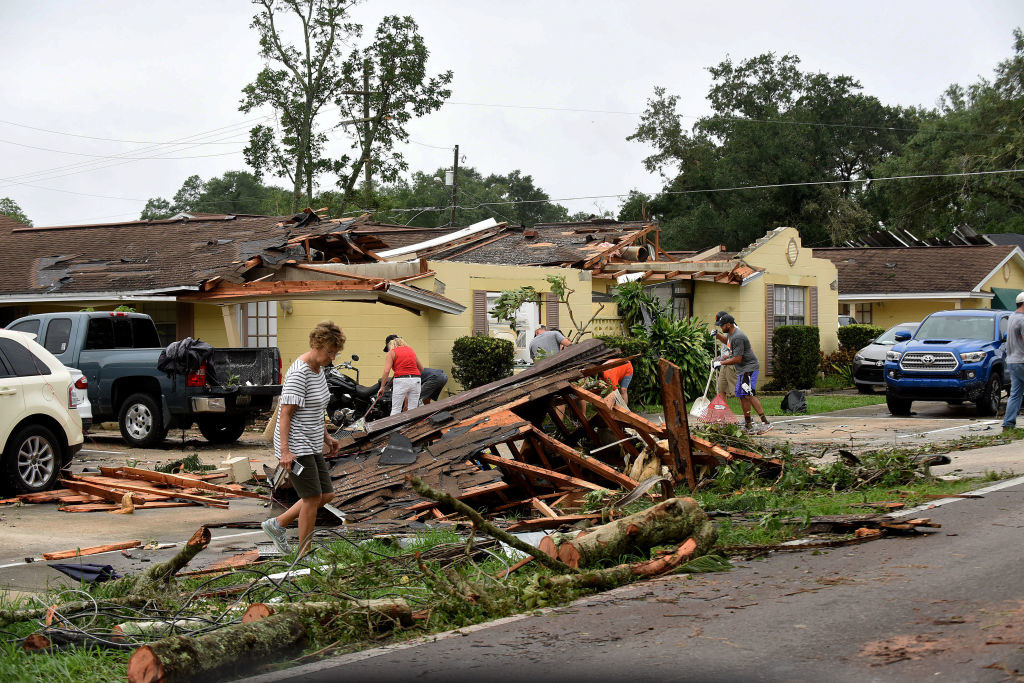
Cristobal struck twice, first hitting Central America, under its Pacific Basin name of Amanda, and later the US. This was the first of five storms to make landfall in Louisiana, causing some flooding there, and continued north all the way to Wisconsin.
4. Tropical Storm Dolly (June 22–24):
Dolly was a short-lived storm that lived and died in the Atlantic Ocean.
5. Tropical Storm Edouard (July 4–6):
Edouard was another short-lived storm that never made landfall.
6. Tropical Storm Fay (July 9–11):
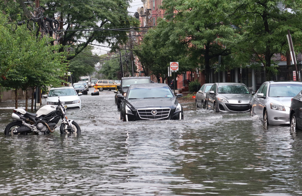
Fay formed from a grouping of thunderstorms; the fleeting storm made landfall in New Jersey with heavy rain.
7. Tropical Storm Gonzalo (July 21–25):
Gonzalo had already started to weaken before reaching Trinidad and Tobago, and then it fizzled out.
8. Hurricane Hanna (July 23–27):
Hanna was the first hurricane of the season, making landfall in South Texas as a Category 1 storm. The storm dumped more than 15 inches of rain in some places, triggering flash flooding, and caused widespread power outages.
9. Hurricane Isaias (July 30–Aug. 5):
Another Category 1 hurricane, Isaias was a fast-moving, deadly storm that unleashed dozens of tornadoes and heavy rain on the East Coast.
10. Tropical Storm Josephine (Aug. 11–16):
Josephine was a weak storm that never came close to land.
11. Tropical Storm Kyle (Aug. 14–16):
Kyle was another brief storm that never left the ocean.
12. Hurricane Laura (Aug. 20–28):
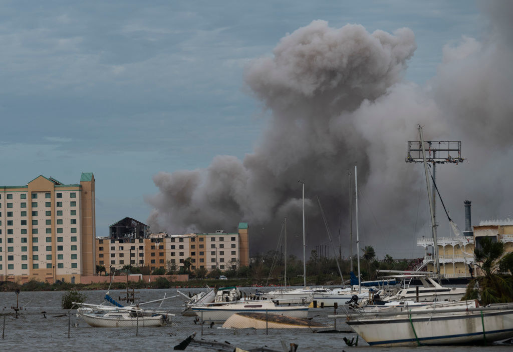
Laura was the first major hurricane of the season and the strongest on record to make landfall in the southwestern corner of Louisiana. After rapidly intensifying to a Category 4 storm, Laura killed at least 26 people, caused thousands to evacuate, and sparked a chemical plant fire.
13. Hurricane Marco (Aug. 20–25):
Marco was a short-lived hurricane that formed in the Gulf of Mexico and made landfall as a tropical storm near the mouth of the Mississippi River.
14. Tropical Storm Omar (Aug. 31–Sept. 5):
Omar was another storm that never touched land.
15. Hurricane Nana (Sept. 1–4):
Nana slammed into Belize as a Category 1 storm, dumping rain across Central America.
16. Hurricane Paulette (Sept. 7–22):
After striking Bermuda as a Category 1 hurricane and then strengthening to a Category 2, Paulette weakened at sea only to reemerge as a “zombie” tropical storm days later.
17. Tropical Storm Rene (Sept. 7–14):
Rene formed during one of the most active weeks of the season and never left the ocean.
18. Hurricane Sally (Sept. 11–17):
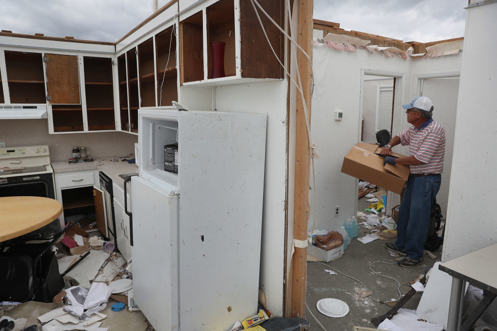
Sally made landfall as a Category 2 storm in Florida, drenching parts of the state with about 30 inches of rain and temporarily knocking out power for hundreds of thousands of people in the South.
19. Hurricane Teddy (Sept. 12–22):
After rapidly intensifying to a Category 4 hurricane at sea, Teddy transformed into a “ginormous” post-tropical storm stretching 1,000 miles wide that struck Canada.
20. Tropical Storm Vicky (Sept. 14–17):
Vicky was another weak storm that stayed at sea.
21. Tropical Storm Beta (Sept. 17–22):
Beta was the ninth storm of the season to make landfall in the US, hitting Texas and dropping heavy rain across the region.
22. Tropical Storm Wilfred (Sept. 18–20):
The last storm of the season with a traditional name, Wilfred headed from near the coast of West Africa to the central Atlantic before fizzling out.
23. Subtropical Storm Alpha (Sept 18):
Alpha was the first storm with a Greek alphabet name to hit the Atlantic since 2005.
24. Tropical Storm Gamma (Oct. 2–5):
Gamma rapidly intensified to near-hurricane strength before making landfall on Mexico’s Yucatán Peninsula, where it dumped heavy rain, causing floods and landslides.
25. Hurricane Delta (Oct. 4–10):
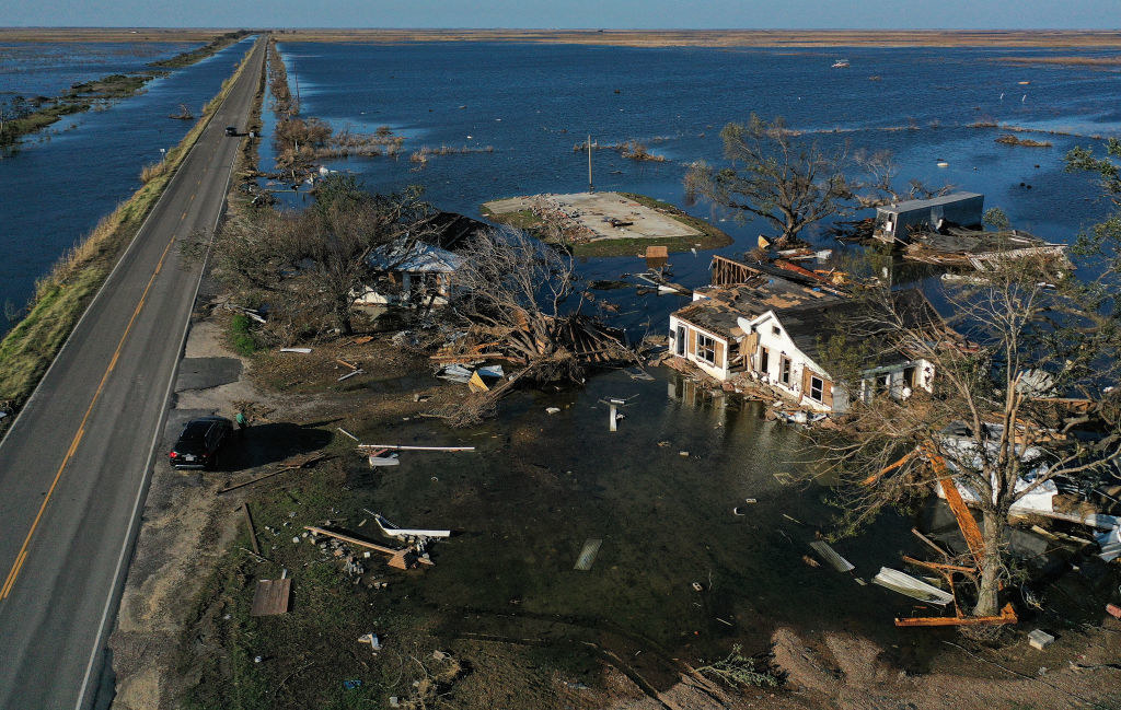
Delta was yet another powerful hurricane to slam into Louisiana this year, making landfall as a Category 2 storm in the same region that was still recovering from Laura.
26. Hurricane Epsilon (Oct. 19–26):
Although one of the season’s many rapidly intensifying storms, reaching Category 3 strength at its peak, Epsilon stayed far from land.
27. Hurricane Zeta (Oct. 24–29):
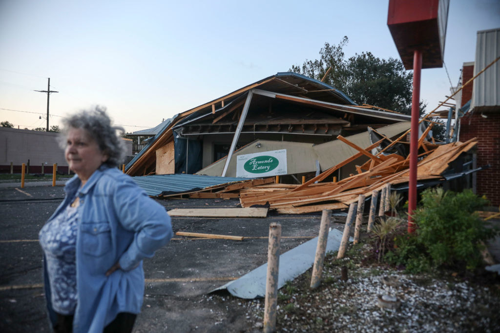
After rapidly intensifying, Zeta made landfall in Louisiana as a Category 2 storm and caused massive power outages.
28. Hurricane Eta (Oct. 31–Nov. 13):
Eta was a long-lived hurricane that first slammed into Nicaragua as a Category 4 storm, soaking much of Central America and triggering dangerous mudslides. It then crossed Cuba, hit the Florida Keys, and made a loop in the Gulf of Mexico before crossing northern Florida and heading out into the Atlantic.
29. Tropical Storm Theta (Nov. 10–15):
Theta’s formation officially made 2020 the busiest hurricane season on record.
30. Hurricane Iota (Nov. 13–18):
Iota was the strongest hurricane on record to slam into Nicaragua, making landfall as a Category 4 hurricane that tore the roof off a hospital, flooded streets, and prompted thousands to evacuate.

